Environmental Observatory
GAMUT: Gradients Along Mountain to Urban Transitions
iUTAH EPSCoR was broadly recognized for its well-established network of environmental observatories in the state. GAMUT or ‘Gradients Along Mountain to Urban Transitions,’ a network of 42 aquatic and climate sensor stations measured and recorded climate, hydrology, and water quality along the Wasatch Front for over five years. View the GAMUT Fact Sheet.
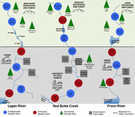
The GAMUT sensor stations, located in three of Utah’s most populated watersheds: Red Butte Creek, Logan River, and Provo River, traversed the landscape from mountain to urban settings. Data from these stations are monitored and used for solving a wide range of water-related problems. From diagnostics and restoration of impaired urban rivers to modeling future water availability, the data help identify irregularities in Utah’s waterways. With the support of Utah’s three research institutions, Brigham Young University, the University of Utah, and Utah State University, data will continue to flow from these observatories long after the iUTAH project ends in 2018.
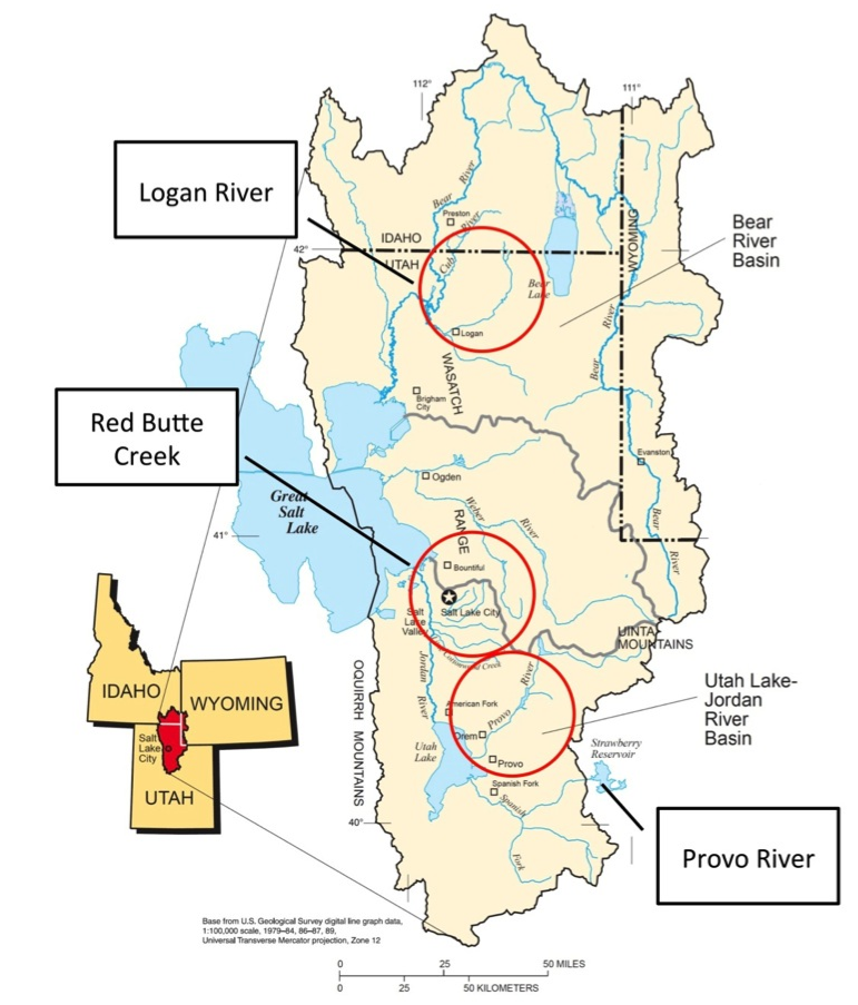
Location of the three GAMUT watersheds in northern Utah, USA
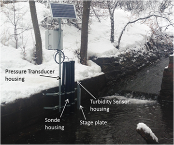
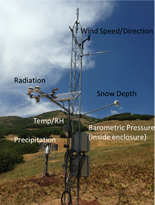
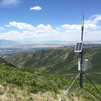
GAMUT sites in Red Butte Creek watershed with typical aquatic (left) and climate (right) sensor deployments.
Cyberinfrastructure for GAMUT
A key component of the iUTAH GAMUT network was its cyberinfrastructure, which included computing systems, data storage and retrieval systems, and visualization environments. The human component of this network involved technically trained individuals skilled at linking software and computing resources to environmental data to improve research capacity.
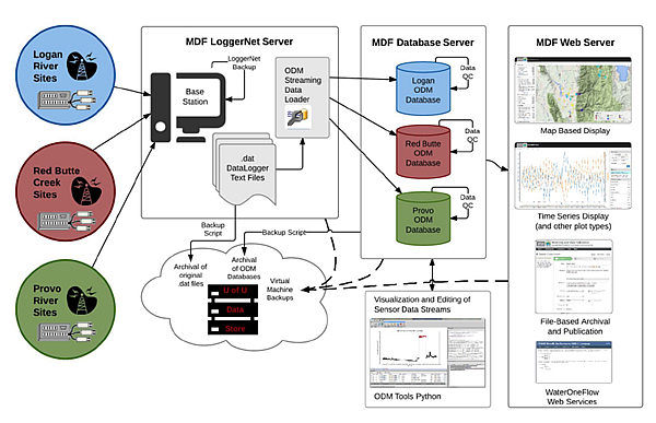
This is a workflow illustrating the steps in the flow of GAMUT data and the CI tools deployed to support it.
GAMUT Data Access
Once GAMUT’s ecological sensors logged and transmitted data, the information stored in databases was made available via various mechanisms, including an open access web-based tool for exploring and accessing GAMUT data. GAMUT data monitoring took place at 15-minute intervals and was downloadable and/or available for viewing online. Archived data can also be accessed via HydroShare, an online data repository.
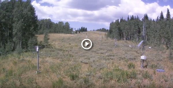
Current conditions at each site in each GAMUT watershed:
GAMUT Presentation and Article

View this presentation to learn more about GAMUT extensions of data and research products
This paper features an in-depth review of the mountain urban water system in Utah. “Designing and Implementing a Network for Sensing Water Quality and Hydrology across Mountain to Urban Transitions” discusses the logistics of developing and maintaining the Gradients Along Mountain to Urban Transitions (GAMUT) network. It was published on September 2017 in Journal of the American Water Resources Association (JAWRA).