iUTAH Team - Undergraduate iFellows
Lindsay Capito
Utah State University
Mentors:
Faculty: Sarah Null, USU
Near-Peer: Maggi Kraft, USU
Research Focus:
Research Focus Area 3
Project: Assembling systems modeling data for the Bear River basin
Major:
Restoration and management of aquatic ecosystems
Biography:
Lindsay Capito grew up in Kamas Utah, where she spent the majority of her time outdoors. As a child, every summer was spent camping, fishing, and being around or preferably in the water. After high school she moved to Northern Arizona and tried on a variety of hats, including but not limited to; waitressing, selling motorcycles and natural groceries (separately) and eventually working in an emergency room. After some time in the ER and with exposure to the multitude of career paths offered in the field of biology, she turned her focus to the environment. She was accepted to Utah State University and started classes in the fall of 2015. She will finish her bachelor’s degree in restoration and management of aquatic ecosystems next spring and plans to attend graduate school thereafter.
Research Abstract:
Evaluating Model Accuracy for Fish Habitat in the
Weber Watershed
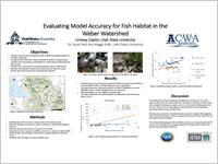
Presented by: Lindsay Capito,
July 2017
Evaluating model accuracy for fish habitat in the Weber watershed
This study assessed accuracy of modeled predictions for fish habitat parameters in the Weber River watershed through collection and comparison of temperature and discharge data. Estimated parameters, including temperature and NHD discharge were input into a GIS based model to classify reach conditions as poor, fair, good, or excellent Bonneville cutthroat trout habitat. Measured field data was collected at 44 sites and statistically compared to validate estimated temperature and discharge values and conditions. Sites were selected for measurement through evaluation of accessibility and feasibility, with the goal of collecting measurements throughout the entire watershed. Using a YSI probe temperature (°C), dissolved oxygen (mg/L and %/L), salinity (ppt), and specific conductance (microsiemens/cm) were measured at stream sites. If wadable, streams discharge was measured using a handheld Marsh McBurney flowmeter. Geomorphic conditions were assessed visually and substrate composition was measured using the Wolman Pebble Count technique. Measured temperature and discharge data were compared to modeled data to statistically quantify, bias, percent bias, root mean square error, and Nash Sutcliffe Efficiency. Measured values that deviated significantly from expected values were spatially represented and compared to barrier locations to determine if barriers are responsible for high error values.
Weekly Recap:
Week 1 | Week 2 | Week 3 | Week 4 | Week 5 | Week 6 | Week 7 | Week 8 | Week 9 | Week 10 | Week 11
Week 1: May 15-21, 2017
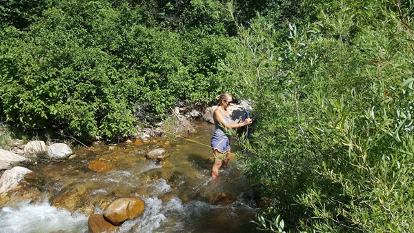
This week Mike and I were introduced to the ACWA lab at USU. The week began with introductions to the students working in the lab and a tour of the facilities. We then brainstormed with the team about what type of data we will be collecting and devised a plan for identifying potential sample sites. I read several papers to familiarize myself with the Weber River, native fish, and statistical methods used to validate models. We were trained on how to operate and calibrate the YSI probe, used for measuring dissolved oxygen, temperature, and TDS. We then ran through a demonstration with the Marsh McBurney flowmeter and measuring devices that we will use for discharge measurements. We also researched and downloaded historic elevation levels for Utah reservoirs and complied spreadsheets with the information. We may even get in the river to practice measuring discharge later today!
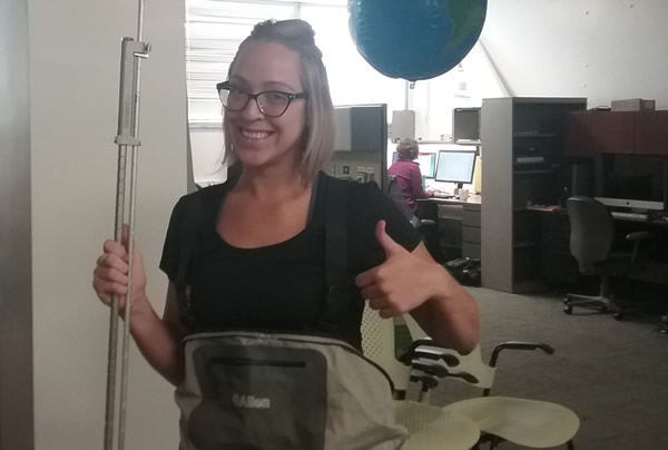
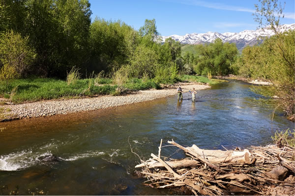
Waders and Measuring Discharge
Week 2: May 22-28, 2017
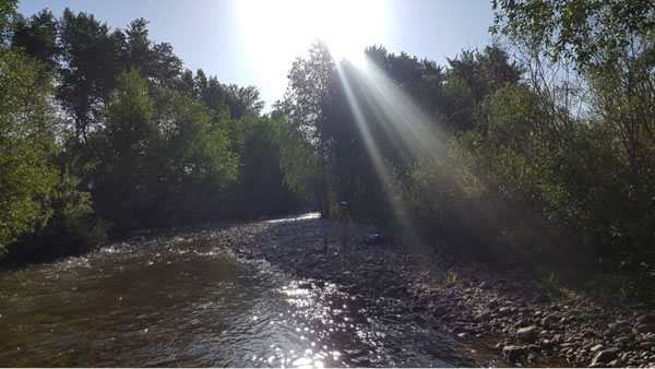
This past week was great! We were able to go into the field Tuesday, Wednesday, and Thursday to collect discharge and water quality measurements. The weather was awesome and we practiced using the equipment and recording data. This week also helped me think about the challenges in finding field sites in a watershed that is primarily private property. Dr. Null helped me clarify my research question and think about how I will address it. Looking forward to more great days in the river!
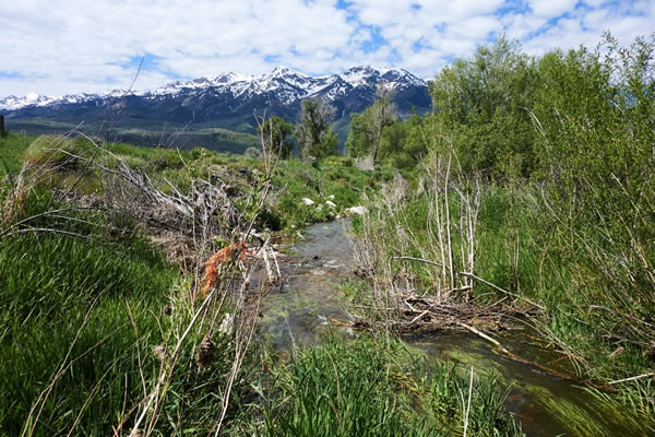
Picture from a tributary to the Weber River near Snowbasin Resort.
Week 3: May 29-June 2, 2017
This week we found more sites to take measurements in Weber and Morgan counties. We were also granted access to a site that has been on our priority list so that was great news! The process of taking measurements and assessing geomorphic condition is running more smoothly now as we are becoming more familiar with the equipment. We visited a site near the North Ogden divide on Thursday where it appears someone has cemented the edges of Chicken Creek. Why? I’m not sure, but it doesn’t seem like good fish habitat to me…
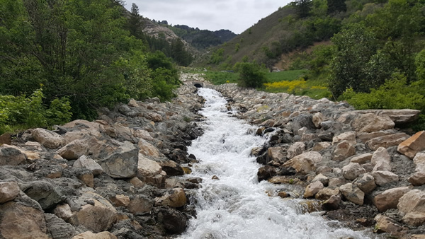
See the cemented stream
Week 4: June 5-9, 2017
This week we spent some time discussing how the data we are collecting will be analyzed, had some training on the RTK, and spent two days in the field collecting data. Field sites this week included repeating some measurements in Morgan County, taking new measurements at Kamp Kissel near Causey Reservoir, and new measurements in Park City. The RTK is a really neat GPS surveying device that we will use to measure the slope of the river. You can see it set up in the photo below, taken at Cottonwood Creek in Morgan County.
RTK GPS surveying device used to measure the slope of the river, at Cottonwood Creek in Morgan County
Week 5: June 12-16, 2017
This week was so great! We were able to measure a part of the river we’ve been wanting to get to all summer thanks to a very gracious landowner. Not only did she let us access the river through her property, she hung out with us all day finding places to measure and even taking photos. We also revisited some sites to get repeat measurements. We found that one stream we visited was almost entirely dewatered. We worked a bit on how to analyze the data we have been collecting and how to visually represent what it all means.
Week 6: June 19-23, 2017
This week we went to the Uintah mountains to get headwater measurements for the Weber and Bear River. It was so nice! We measured 10 sites in the Uintahs Tuesday and Wednesday, then headed to Ogden to measure the confluence of the Ogden and Weber Rivers. All in all a very productive and fun week!
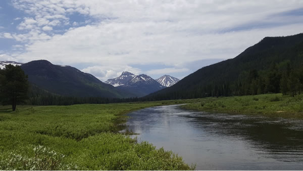
Christmas Meadows in the high Uintahs. Stillwater feeds the Bear River.
Week 7: June 26-30, 2017
This week we spent more time on putting the data we have collected into a more manageable format and running statistics. One day was spent matching up field sites to the gis model in order to run statistics. Wednesday, we had a very productive lab meeting and I received lots of great feedback on my ideas for how to graphically represent the data. Thursday, we hit some sites in Ogden valley that had previously been too high to measure then ended the day with a lab BBQ at Dr. Nulls house. It was nice to spend time with our lab mates outside of work. It feels like things are starting to really come together but I have to say I’m sad to be winding down field work!
Measuring discharge near Powder Mountain Ski Resort.
Week 8: July 3-7, 2017
This week was spent fiddling with graphs and figures for the poster presentation. I am using GIS for mapping and analyzing measured conditions and then comparing them to modeled predictions. My ArcMap skills proved a bit dustier than I thought, but after several failed attempts at importing xy data and several Youtube videos later… success! The cohort meeting went really well and I received some useful feedback on the design of my poster. Presenting to the group also helped me see the areas I’m not as comfortable talking about and still need practice with. Looking forward to the symposium.
Week 9: July 10-14, 2017
This week I was nervous and excited for the symposium! This was only the second poster I’ve presented and the first for a project that I’ve seen from start to finish. The symposium was a blast! I really enjoyed all of the presentations and getting to see the other ifellows posters. The BBQ at Andy’s place was definitely a highlight! It was nice to socialize with everyone outside of the cohort session format. I am sad to be winding down the program but hope to keep in touch with the iUtah community going forward! No pictures this week but as I am putting together my presentation I have come across many from field work.
Mike and I measuring discharge on the Weber River early in the season.
Week 10: July 17-21, 2017
This week I spent most of my time working on the power point presentation as well as uploading data to Hydroshare. I have been tormenting my friends and family with impromptu speeches about fish habitat and obscure statistics after which they smile and nod and say, “I love your pictures!”. Just kidding, I have been given some great feedback including from everyone at the lab and as always Mike. Things are wrapping up but I still have much to do. No field pictures from this week but I thought I’d share another taken a few weeks ago near Smith and Morehouse Reservoir.
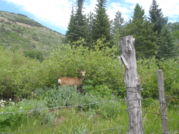
A deer near Smith and Morehouse Reservoir
Week 11: July 24-28, 2017
No entry
All content provided on this iUTAH Team - Undergraduate iFellows weekly recap is unedited, updated by each participant to provide a review of their progress, and is for informational purposes only.