iUTAH Team - Undergraduate iFellows
Michael Fowles
Weber State University
Mentors:
Faculty: Sarah Null, USU
Near-Peer: Maggi Kraft, USU
Research Focus:
Research Focus Area 3
Project: Measuring aquatic habitat to support local fisheries
Major:
Applied Environmental Geoscience
Biography:
Michael Fowles is a senior studying applied environmental geoscience at Weber State University. He currently works for the Geoscience Department at Weber State as a forest water chemistry research assistant. He has lived in northern Utah most of his life, and from an early age became curious about nature and the environment and learned to love the natural beauty of our surroundings. He enjoys skiing, hiking, biking and trail running throughout the mountains of Utah, and looks forward to learning more about the impacts of rural and urban land use on local fisheries.
Research Abstract:
Quantifying Spatial Variability of Habitat Suitability Parameters in the Weber Watershed
Presented by: Michael T. Fowles
July 2017
The purpose of this study was to quantify the spatial variability of habitat parameters important for native fish in the Weber watershed and determine if they are correlated to elevation or stream order. The watershed is located in northern Utah and spans Weber, Morgan and Summit Counties. Sites were selected by using various layers in GIS and other spatial mapping tools to determine land ownership and potential access points. Data collected at selected sites include water quality parameters, such as stream temperature (°C), dissolved oxygen (mg/L), total dissolved solids (µs/cm), and salinity (ppt). Geomorphic conditions and a pebble count to quantify substrate were also recorded at each site. These data were averaged by Strahler stream order (1-5) and six elevation bands between 4000’ and 8500’. The data show that there is no direct correlation between habitat parameters and elevation or stream order with one exception. The exception is that temperature is correlated with stream order, with an r² of 0.8. This means that as stream order increases, average temperature also increases in the Weber watershed. With regards to quantifying spatial variability, temperature is most and least variable in 2nd and 3rd order streams, respectively. Both dissolved oxygen and total dissolved solids were most and least variable in 4th and 5th order streams, respectively. This analysis can be applied to future projects in the Weber watershed. Further studies using these data and selected sites could include temporal variation, and variation due to land use.
Weekly Recap:
Week 1 | Week 2 | Week 3 | Week 4 | Week 5 | Week 6 | Week 7 | Week 8 | Week 9 | Week 10 | Week 11
Week 1: May 15-21, 2017
This week began with an introduction to the group I’ll be working with throughout the program. We met Tuesday morning to go over the initial plan and get to know each other. I worked on getting caught up to speed on the research so far and what is to come by reading several journals and published papers. I was given an introduction to several pieces of equipment we will be using this summer and was able to take them out to learn how to use them in the field. I also worked on gathering historic levels of Utah reservoirs, created a list of geomorphic indicators we can use to identify river conditions in the field, and mapped out potential sites to visit within the Weber watershed.
Week 2: May 22-28, 2017
This week we spent time searching for sites to visit in the Weber Basin Watershed. Most of the sites were located in Morgan and Summit counties where we spent three days taking measurements such as velocity, discharge, temperature and specific conductance. We also described vegetation, geomorphic conditions, and completed a pebble count at each site.
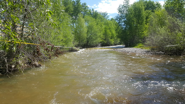
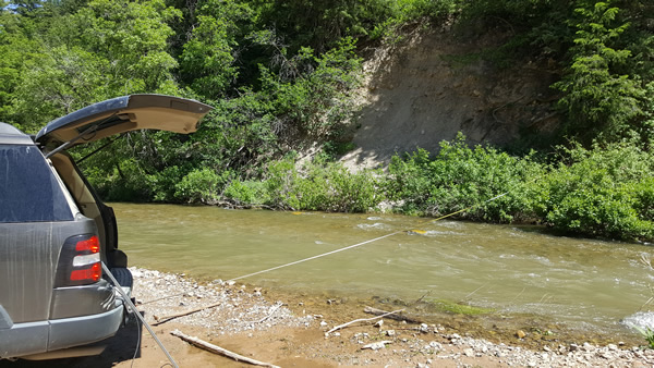
Cottonwood Creek in Morgan County is one of several sites we visited to take measurements this week..
Week 3: May 29-June 2, 2017
This was a productive week as we traveled to many beautiful sites. We visited several tributaries to the Weber and Ogden rivers in the Weber Basin Watershed including sites in Morgan, Summit and Weber counties. We identified barriers at several sites such as Chicken Cr. (Weber county) and Lost Cr. (Morgan county, above the reservoir) which can be used to verify predicted modeled locations.
Unfortunately, with higher temperatures this week, the flow of many of the sites we visited was too high to wade in to take velocity and discharge measurements, though we were able to gather other data. We will revisit these sites in the coming weeks.
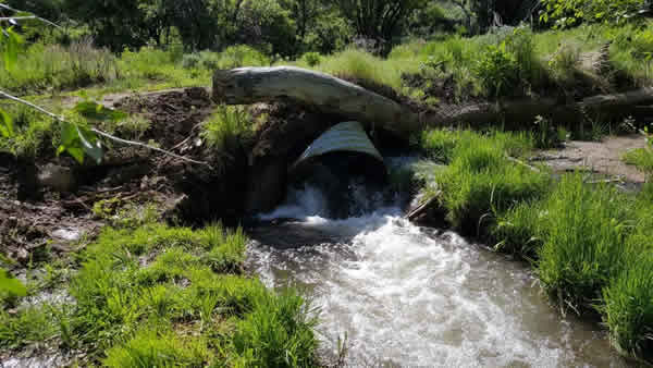
Barrier in Lost Creek, Morgan county
Week 4: June 5-9, 2017
This week Lindsay and I began by identifying possible locations to take new measurements. We had contacted the Boy Scouts of America last week for permission to access a few streams near Camp Kiesel just east of Causey Reservoir in Weber county. They graciously gave us access to the property and we were able to take some great measurements there this week.
We also found several access sites in Park City and intended to remeasure a few sections in Morgan county to help us calculate short term temporal variability. We found a reach of the Weber river we had measured previously was running several feet higher, unfortunately making it inaccessible.
While in Park City we met up with our near-peer mentor, Maggi Kraft, who walked us through her model, taught us how to deploy and read temperature loggers and use a Real Time Kinematic (RTK) sensor that we will be using to get cross sections and measure gradient at each site.
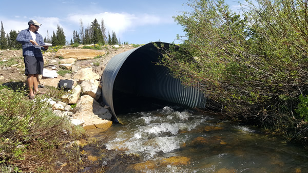
We had to improvise to set up a site for discharge measurements. Near Camp Kiesel, Weber County
Week 5: June 12-16, 2017
This week we spent Monday finding more sites for field work and shoring up access to some private property. Unfortunately we were rained out on Tuesday, however I were able to work with some data that we had already gathered to continue working on spatial and temporal variation of native fish species habitat in the Weber watershed.
We were graciously granted access to 10,000 acres of private property with several important streams just north of the Uinta Mountains. Thanks to this access, we were able to take measurements closer to the headwaters which will help show differences in spatial variation.
Week 6: June 19-23, 2017
This week I was fortunate enough to spend 3 days in the field. We were able to collect data at 16 new sites in the Weber and Bear River watersheds.
On Tuesday and Wednesday we were able to collect data closer to the headwaters of several tributaries to the Weber and Bear Rivers in the Uinta Mountains.
Thursday we were able to get measurements on the Ogden River below Causey reservoir. We also collected data for both the Ogden and Weber Rivers right above the confluence and an additional measurement after the Ogden had joined the Weber and had mixed.
It was interesting to see the differences in conditions from near head-water locations to close to the terminus of the Weber River. Temperature had almost doubled between these locations and other parameters such as specific conductance had also increased substantially.
Gathering and recording water quality at West Fork Bear River above Whitney Reservoir close to its headwaters in the Uinta Mountains.
Week 7: June 26-30, 2017
This week I worked with data we have been collecting in the field over the past several weeks. Using both elevation and stream order, I was able to graph data to see if there was any correlation between stream habitat quality and where in the watershed it was located.
We were also able to get one day in the field. We focused on several tributaries to the Ogden River on the northern side of the Ogden Valley which will help spatially round off our data collection sites within the Weber Basin watershed.
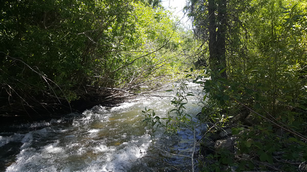
North fork Ogden River
Week 8: July 3-7, 2017
This week was very productive. We were not able to get into the field, however, on Friday we visited Red Butte Dam with those who manage the research area which was both educational and interesting.
Most of the week was spent analyzing data collected in the field throughout May and June. I also got a draft of a research poster completed and got some valuable feedback from other iFellows in preparation for the iUTAH symposium next week.
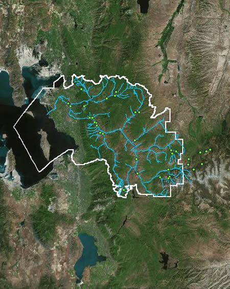
GIS map of the Weber watershed extent, sites visited and stream network
Week 9: July 10-14, 2017
This week I worked on finalizing data analysis and maps to include in my poster presentation for the iUTAH symposium. Monday and Tuesday I created maps in GIS for highest and lowest variability of habitat parameters in the Weber watershed to include in my presentations.
After meeting with my research mentor, Dr. Sarah Null, on Wednesday to get her final feedback on my poster, I got a few layout questions answered and was able to get my poster printed and ready.
The iUTAH symposium Thursday and Friday was a great experience. I was able to present my poster and make valuable connections with people from all levels of the iUTAH team.
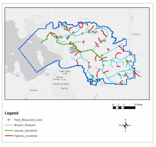
GIS map of dissolved oxygen's highest and lowest variability in red (2nd order streams) and
green (5th order streams) respectively.
Week 10: July 17-21, 2017
This week we were focusing on cleaning up the field data Lindsay and I had gathered between mid May and early July. We got the data up on hydroshare and will be publishing it soon. I also began putting together a power point presentation for the iFellow symposium coming up next week. On Thursday Lindsay and I met with two of Dr. Sarah Null's grad students to give a draft talk of our presentations and got valuable feedback. I've also been writing my extended abstract for the program. I will be continuing to refine both these projects in the coming days.
Week 11: July 24-28, 2017
As this program was coming to a close, I had the opportunity to give a presentation of my summer research to other iFellows and their mentors in addition to some iUTAH staff. The presentations were held on Wednesday. Earlier in the week I put the final touches on the presentation with input from my mentors as well as rehearsed my talk more times than I'd like to admit. Thursday and Friday I finished up my extended abstract and other final program necessities.
During the program, I was fortunate enough to visit many beautiful places across northern Utah, make valuable connections with water researchers from across the state, and make several friends. I look forward to taking this experience with everything I learned and apply it to my future as I continue to pursue a degree and ultimately a career in water science. This program has been a wonderful experience. I've learned a lot, grown as an individual, and am proud to have been a part of it.
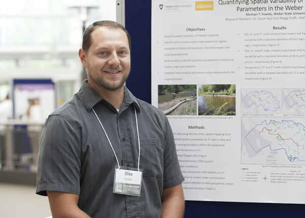
Mike stands by his research poster at the 2017 iUtah Symposium
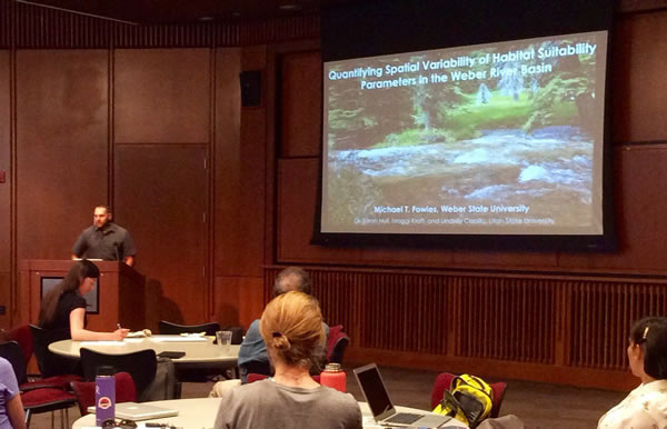
Mike presents his oral presentation at the 2017 iFellows Research Symposium
All content provided on this iUTAH Team - Undergraduate iFellows weekly recap is unedited, updated by each participant to provide a review of their progress, and is for informational purposes only.