iUTAH Team - Undergraduate iFellows
Heather Bottelberghe
Salt Lake Community College
Mentors:
Faculty: Sarah Null, USU
Graduate: Dave Betts, USU
Research Focus:
Research Focus Area 3
Major:
General Studies AS/Geology BS
Biography:
Heather Bottelberghe is a student at Salt Lake Community College where she is earning a General Studies AS. When her AS is completed she will transfer to a four-year college to study geology or watershed science. Heather loves learning about environmental science and geoscience, or anything that has to do with the biosphere. When Heather has completed her Bachelor’s degree she plans to be involved in water research using GIS.
iFellow Presentation:
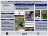
Mosaicking and Georeferencing Thermal Infrared Imagery of Swaner Preserve, Park City Utah
Presented by: Heather Bottelberghe
July 2016
Weekly Recap:
Week 1 | Week 2 | Week 3 | Week 4 | Week 5 | Week 6 | Week 7 | Week 8 | Week 9 | Week 10 | Week 11
Week 1: May 16-20, 2016
Monday was the summer iFellows orientation. There I was able to officially meet the other iFellow interns who will be my peers for this summer. I also officially met the professor I will be doing my research with, Dr. Sarah Null (USU). The rest of the week involved getting set up in the Aquatic Habitat, Climate, and Water Analysis lab (ACWA) at Utah State University and initializing the first steps for our project. Andrew Hackett (another iFellow) and I worked together inputting existing data into ArcGIS to map out the canal system in Logan.
Using ArcGIS to map municipal boundaries of Utah's urbanized areas for RFA 2
Week 2: May 23-27, 2016
This week we met with Tommy a graduate student in the GIS/Remote Sensing lab who showed us how to work with an Infrared (IR) imagery software. Maggi Kraft a graduate student in USU's ACWA Lab used a drone to record thermal IR video of the Swaner Preserve in Park City, Utah. Andrew Hackett and I will process the video to find specific frames that we can combine to make a mosaic. We will georeference the thermal IR mosaic using ground control GPS points that are visible on the images. The thermal IR videos were really exciting to watch, I cannot wait to start creating the mosaic!
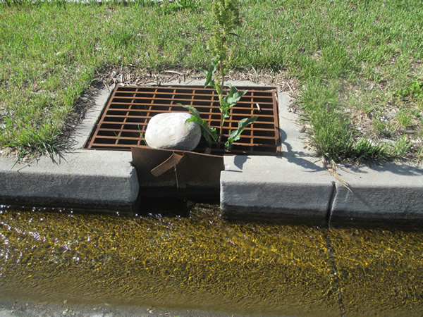
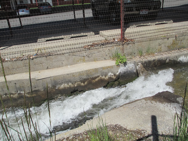
On Friday, Andrew and I began documenting the locations of street gutters in Logan City that are being used to convey secondary water sources to homes so that people can use it to irrigate their lawns. I was glad to finally see first hand how the water is diverted and delivered to people’s lawns and gardens. Some people use sand bags to reroute the water flow and flood it into their yards. Others have a "gate" that when opened allows the water to flow into a canal or ditch in their yard that they can then use to flood their yard or to connect to a pump for sprinklers. Our goal is to map out all of the streets in the urbanized Cache Valley that are used to deliver secondary water to residential land.
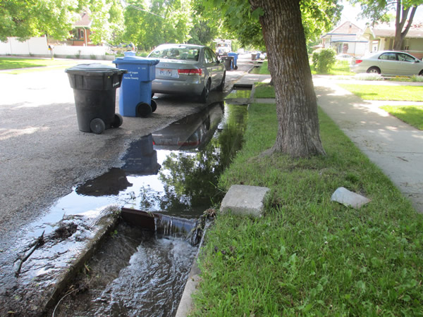
A street gutter overflowing with irrigation water
A "gate" that is shut. When opened, it allows the water to enter the storage container to be used for the yard
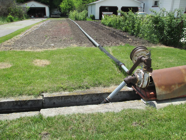
A pump is used to convey water from the ditch and irrigate the garden
Week 3: May 30-June 30, 2016
This week was great! I was able to see more of Cache Valley while looking at street gutters.
On Tuesday we went to Wellsville and saw a variety of secondary water conveyance methods. Unfortunately, the canals in Wellsville were dry so we were unable to accurately determine which irrigation ditches and street gutters are actually used.
Wednesday and Thursday we rode our bikes and walked the streets of several Logan neighborhoods. With a map on a clipboard we were able to mark all of the blocks and streets whose gutters do not convey irrigation water. We saw a few canals and took many photos to document our experience.
On Friday we took a rest from field work and spent our time in the lab digitizing the data we have collected so far into an ArcGIS map layer.
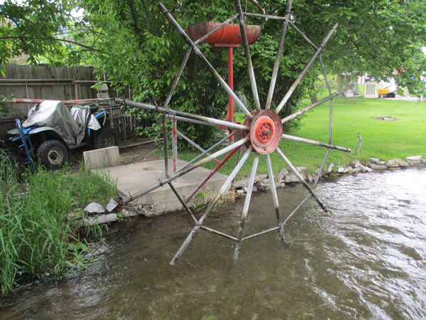
A working water wheel on a canal.
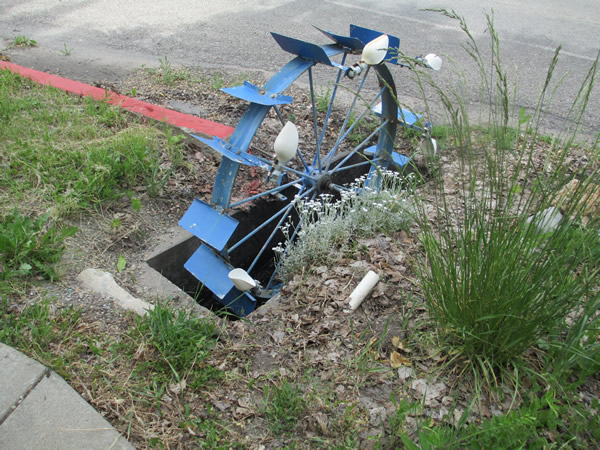
A water wheel in a cement gutter. This one was not moving because it was clogged with dead leaves and trash.
Week 4: June 6-10, 2016
This week was more of the same. Andrew and I continued to map the irrigation gutters in Cache Valley and digitized the curbs in ArcGIS.
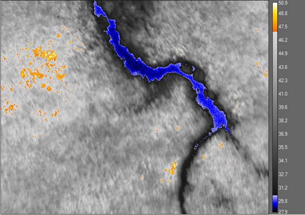
I also became familiar with ResearchIR which is the software we are using to extract frames from thermal infrared (IR) video taken by Maggi Kraft on Swaner Preserve in Park City. I will be mosaicking the IR images to visually represent the radiant temperature of the water in Swaner Preserve. The finished mosaic will be used to identify locations where incoming water temperature varies. Maggi is studying the effect of variant water temperatures on the health and existence of aquatic life that reside in Swaner Preserve.
Week 5: June 13-17, 2016
Monday was our third iFellow cohort session. All of the iFellow interns met in Provo at BYU. We did some fun exercises to practice presenting our research topic. Later that day we went to Provo Canyon where I learned how to measure the flow of a river using a flow gage and I also participated in testing water samples for phosphate, nitrate, sulfate, and E. coli. I loved the water sampling field trip, it was so much fun!
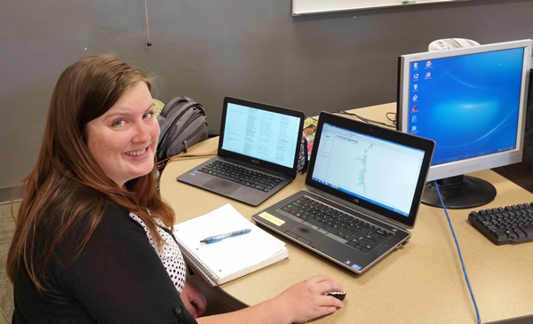
The rest of this week was spent working in the lab with computers. Some time was spent digitizing the curbs layer for the Cache Valley irrigation research. I also began working with Photoshop and another mosaicking software to find the best way to mosaic the thermal IR imagery taken at Swaner Preserve. It is amazing to see the output after the software processes the images.
Week 6: June 20-24, 2016
This week I worked a lot with the infrared imagery software Research IR. With Research IR I can adjust the colors used to represent the pixels in the infrared video from Swaner Preserve. I have been working on finding a color scale that will best visualize the variance in temperature found in the water on Swaner Preserve. Working with software I am unfamiliar with is a fun challenge, and I enjoy exploring the different outputs as I adjust the palette of colors.
Week 7: June 27-July 1, 2016
This week I finished creating the IR imagery mosaic of Swaner Preserve! I was glad to have all of the image processing done because exporting frames from the IR video and processing the images for the mosaic takes a long time. With a finished mosaic, I was able to georeference the IR imagery in ArcGIS So that the mosaic lays over satellite imagery. Now the Swaner Preserve thermal IR mosaic can be used on maps in ArcGIS. Next week I am going to La Grande, Oregon to help a Utah State University graduate student, Jessica Wood with the fieldwork for her project. She is monitoring a stream near La Grande, and I will be helping take water quality measurements. I am very excited to be out in the field!
Week 9: July 11-15, 2016
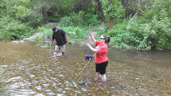
The past two weeks have been jam packed with fun and exciting experiences! Tuesday last week I drove to Oregon with Jess Wood, a Watershed Science graduate student and Andrew Hackett (iFellow). We drove up the mountains near La Grande, Oregon and entered the Starkey Experimental Forest and Range. Jess has been collecting data from a river there called Meadow Creek so that she can create a flow model.
We helped Jess with her field work on this trip for about a week. We hiked through the forest and tall grasses and muddy wetlands to reach the river every day, then we measured the flow of the stream, air and water temperature at different points along the stream's path. It was challenging work, but it was great to learn and practice new skills and gain knowledge about water research.
This Tuesday we returned from Oregon. The rest of the week I worked on creating a poster for presenting my mosaicking project. On Friday I attended the iUTAH All-Hands Meeting where I met other iUTAH participants and learned a lot about the development of iUTAH EPSCor, the goals and accomplishments of iUTAH EPSCor, and I presented my poster in a poster session. I was grateful to receive both compliments on the progress of my project and helpful insight on how to present my project even better in the future.
USU graduate student Jess Wood measures the flow of Meadow Creek while iFellow Andrew Hackett measures the water temperature.
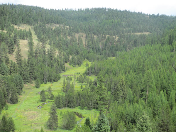
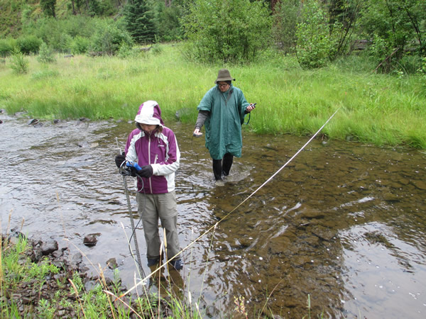
A view of Meadow Creek in Starkey Experimental Forest and Range.
Week 10: July 18-22, 2016
This week is the second to last week of the iFellows program and I am amazed at how much I have accomplished. At the beginning of my internship I was nervous about my lack of skills and experience. But I was wrong to be afraid. My internship has been difficult, but I have overcome challenges on my own this summer that I never would have thought to tackle before this adventure.
This summer I gained a new confidence in my intellect and abilities. I developed professional relationships with peers and mentors that I hope to continue to work with throughout my education and future career. The skills that I learned from my peers and mentors have helped me take the first step on the scaffolding to success. I will look back on this experience with pride for myself for the rest of my life.
All content provided on this iUTAH Team - Undergraduate iFellows weekly recap is unedited, updated by each participant to provide a review of their progress, and is for informational purposes only.